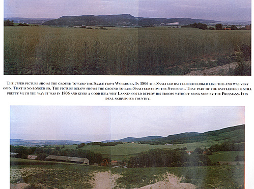
Most of the Saalfeld battlefield has considerably changed since 1806. It is no longer possible to see the entire battlefield as Marshal Lannes did when he emerged from the road to Coburg. Garnsdorf, the suburb of Saalfeld like that city itself, has expanded considerably and is now heavily wooded. All the other battlefield features with the notable exception of that of the Sandberg are no longer recognizable. Prince Louis' area of initial deployment is covered by army barracks.
The Sandberg, as shown on one of the photographs, gives an idea of the ground around Saalfeld in 1806. The map reproduced below gives a good idea on how Lannes was able to deploy his troops without being seen by the Prussians. In addition, it was ideal skirmisher's country.
Upper: Ground towards the Saale from Wolsdorf.
Bottom: Ground towards Saalfeld from the Sandberg and
gives a good idea why Prussian troops could not see Lannes deploy the French.

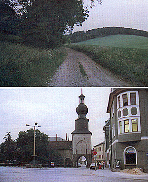
Upper: Old Road from Graffenthal to Saalfeld.
Bottom: Saalfeld, the old city gate to the road from Graffenthal.

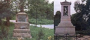
Left: Monument marking spot where Prince Louis was killed.
Right: More recent monument to Prince Louis.

More 1806 Battle of Saalfeld
-
Introduction
I: Grand Army and Lannes' Movement Prior to Battle
II: Initial Situation at Saalfeld
III: Events and Intents from the Prussian Side
IV: Lannes' Initial Disposition and Deployment
V: Preliminary Action on Prussian Side
VI: Prussian Attack
VII: Lannes' Attack
VIII: Combats Around Garnsdorf, Saalfeld, and the Pursuit
IX: Conclusions
X: Further Conclusions
XI: The Battlefield Today
Back to Empire, Eagles, & Lions Table of Contents Vol. 2 No. 6
Back to EEL List of Issues
Back to MagWeb Master Magazine List
© Copyright 1994 by Emperor's Headquarters
This article appears in MagWeb (Magazine Web) on the Internet World Wide Web.
Other military history articles and gaming articles are available at http://www.magweb.com
