
Map #2 shows the absence of good roads (i.e., the solid double line roads) between l'Epine-aux-Bois, Marchais, and the Petit-Morin valley. Only rain-soaked, poor quality secondary roads and dirt tracks crossed the countryside in this area, preventing the Russian artillery from following the infantry and supporting the attack on the French line. It had been raining for two weeks (!) and these secondary roads were impassable. The Russian right extended as far as Pomesson.
The numbers indicate each photograph taken, with the arrows indicating the direction of the picture.
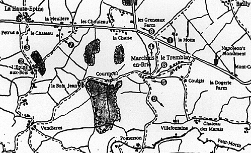
Photo 1: Line where French cavalry deployed NW of mail road with right anchored on Baily Wood. Road on left goes to Le Trembley and Ricard's Division was initially deployed left of road.
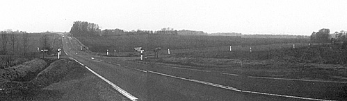
Photo 2: Village of l'Epine-aux-Bois. Sacken launched attack from here.
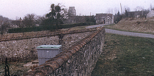
Photo 3: Road from l'Epine-aux-Bois to La-Haute Epine (background), where Sacken counterattacked Ney and Old Guard without success.
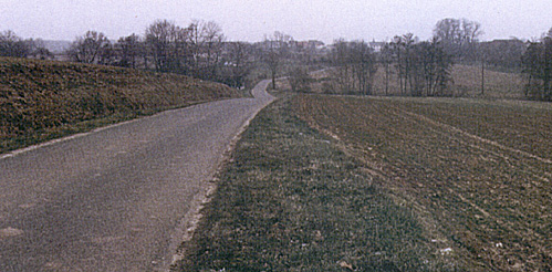
Photo 4: Vilage of Marchais from crossroad. The farm that Ricard's troops took, lost, and retook is at left. The final attack invovled two bttns of Guard chasseurs across the ground shown here.
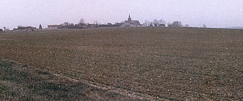
Photo 5: View of Marchais from le Tremblay. The village has not changed much from 1814.
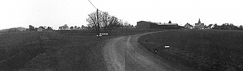
Photo 6: Closer lok at Marchais and the farm that changed hands several times during the battle.
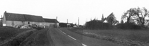
Photo 7: La Haute-Epine viewed from la Meuliere where the foot guard reached the ridge. From there, Ney and Friant attacked La Haute-Epine. It's great country for cavalry. The Guard Dragoons charged on the left of the road toward La Haute-Epine, breaking several Russian squares.
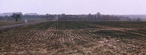
Photo 8: Taken near crossroad towards Chateau Thierry. In 1814, the road was reputed to be almost impassable in winter. Les Greneaux farm where the Russians were entrenched is on the left.
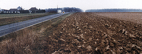
Photo 9: Taken from road from Marchais to Pomesson showing the valley of the Petit-Morin. The road was a dirt track in 1814. Pomesson is behind thewood on the right.
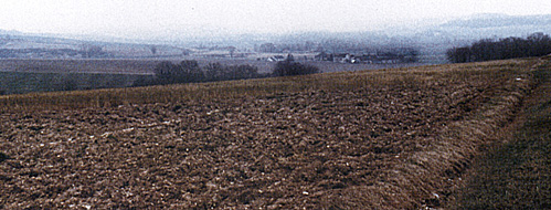
Photo 10: Napoleon's monument marking location of his command post during battle of Montmirail.
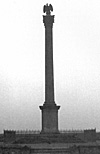
Photo 11: Prussians were deployed in the plain behind the Corbet farm (on right) in front of Fontenelle to Les Tourneaux (on far right not visible in photo). Road to Chateau Thierry is on left. Prussians attacked from this point and apparently reformed here after they were repulsed before retreating to Chateau Thierry.
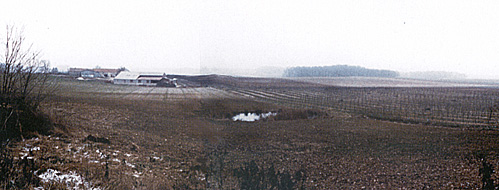
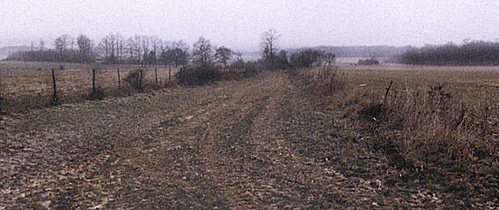
Photo 12: Typical dirt track of the area, adequate to handle local traffic, but after a heavy rain, impassable to artillery.
More Montmirail Part III
-
Battle of Montmirail Introduction
French Accounts of Sacken's Movements
Russian Accounts of Battle of Montmirail
Prussian Accounts of Battle of Montmirail
Battle of Montmirail Order of Battle
Montmirail Battlefield Photographs
Large Map 1 (slow: 123K)
Jumbo Map 1 (very slow: 223K)
Large Map 3 (slow: 182K)
Jumbo Map 3 (very slow: 399K)
Large Map 4 (slow: 122K)
Back to Empire, Eagles, & Lions Table of Contents Vol. 2 No. 9
Back to EEL List of Issues
Back to MagWeb Master Magazine List
© Copyright 1994 by Emperor's Press
This article appears in MagWeb (Magazine Web) on the Internet World Wide Web.
Other military history articles and gaming articles are available at http://www.magweb.com