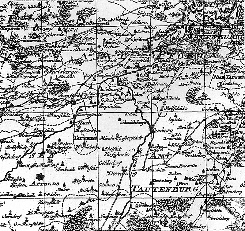
Section from Petri's map of Saxony dated 1763--inaccurate and outdated by 1806. It was from this inadequate cartography than Napoleon planned the destruction of the Prussian army. Principle roads in 1806, primarily the one connecting Dornberg to Apolda, were not shown. For orientation, Naumberg is top right, Jena at bottom left
More Bernadotte and 1806
-
Bernadotte and 1806: Introduction
Bernadotte and 1806: Prosecution's Case
Bernadotte and 1806: Defense's Evidence
Bernadotte and 1806: Defense's Case
Bernadotte and 1806: The Villain: Bernadoote
Bernadotte and 1806: The Hero: Davout
Bernadotte and 1806: Plan A and B Maps
Back to Table of Contents -- First Empire #48
Back to First Empire List of Issues
Back to MagWeb Master Magazine List
© Copyright 1999 by First Empire.
This article appears in MagWeb (Magazine Web) on the Internet World Wide Web. Other military history articles and gaming articles are available at http://www.magweb.com