 Surrender Field
Due to damage from Hurricane Floyd, which eroded part of Wormley Dam and the road atop it, we had to detour back to the Visitor's Center to pick up an alternate route to the Field. It's not that far out of the way and we quickly reached the Field's parking lot.
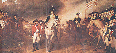
Maj. Gen. Benjamin Lincoln accepts the surrender of the British from Brig. Gen. Charles O'Hara, Cornwallis' second in command.
Jumbo Surrender Painting (monstrously slow: 874K)
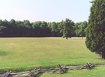
 The original road is lined with split rail fences, but you enter a concrete and brick monstrosity from the opposite side. This ramp leads to an observation platform that overlooks the Field. Push a button embedded into the railing and a very loud description of the surrender plays over loudspeakers.
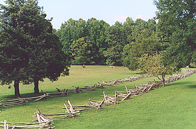
A section of the original road between the split rail fences. Yorktown is roughly northward a mile and a half behind the horsemen.
 As you walk down a ramp that twists around the building like a helix, gun barrels line the ramp. I'm not quite sure why these are not in the Visitor's Center, but there you have it. It's a bit overwhelming. In any case, it drops you off on the original road, and we walked back around to the car.
Surrender field from the top of the helix.
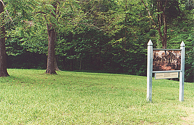
This is also the start of the Yellow Route, otherwise known as the Allied Encampment Tour. You can drive around the battlefield for a few miles. It's all been kept fairly wooded and wild, with a number of signs marking various locations.
The American Artillery Park is the first stop, though little can be seen.
Washington's Headquarters
 Next stop is Washington's Headquarters, a small patch of clearing in the woods. His HQ was a couple of tents with a small house next to it, but the house is gone and there are certainly no tents. These will be recreated in the Visitor's Center.
Jumbo Washington Headquarters Painting (very slow: 216K)
Later on, the French Cemetery and French Artillery Park come into view, the former marked with a simple cross, and the latter a mere indentation in the landscape.
A short drive away is the French Encampment Area overlooking a road. As we backtracked, then continued on the Yellow Route, British outerworks and other redoubts came into view. These were abandoned September 29, one day after the American and French appeared. Finally, we arrived back at the Visitor's Center, parked the car, and set out on foot to Yorktown, the town.
More Yorktown Battlefield
- Introduction
Historical Preliminaries
Visitor's Center
The Quick Tour
Forward March...Ouch! Ouch!
Redoubts 9 and 10
Grand French Battery
Augustine Moore House
Surrender Field
Yorktown Victory Monument
Back to List of Battlefields
Back to Travel Master List
Back to MagWeb Master List of Magazines
© Copyright 2003 by Coalition Web, Inc.
This article appears in MagWeb (Magazine Web) on the Internet World Wide Web.
Other articles covering military history and related topics are available at http://www.magweb.com