Iran-Iraq War fortifications
I have grabbed contemporary satellite views of the fortifications built during the Iran-Iraq war.
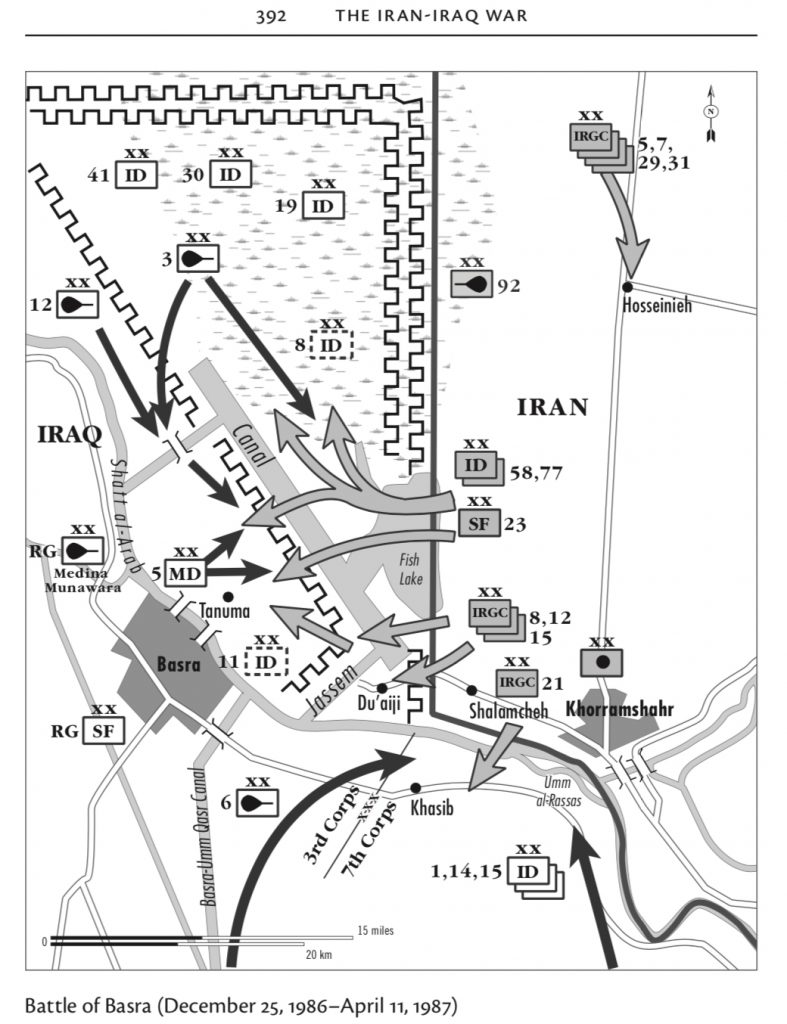
Some details of the historical setting may be found on the map below, taken from the excellent book from Pierre Razoux, “The Iran-Iraq War”.
They are mainly earth berms.
All very interesting since geometrical patterns where 3 is recurring may be identified. Not yet clear if the lower level berms were supposed to host platoons or squads.
From the highest altitude view, a double line of triangular defences may be identified. Looking at the above map, Two divisions were given the defence of the North sector, i.e. 18 infantry battalions in total. It is possible to spot about 16 large triangles in two rows. An additional two might have a different orientation, either on the fortifications looking east or the oblique lines oriented NW, which may be seen on the very top right of the picture.
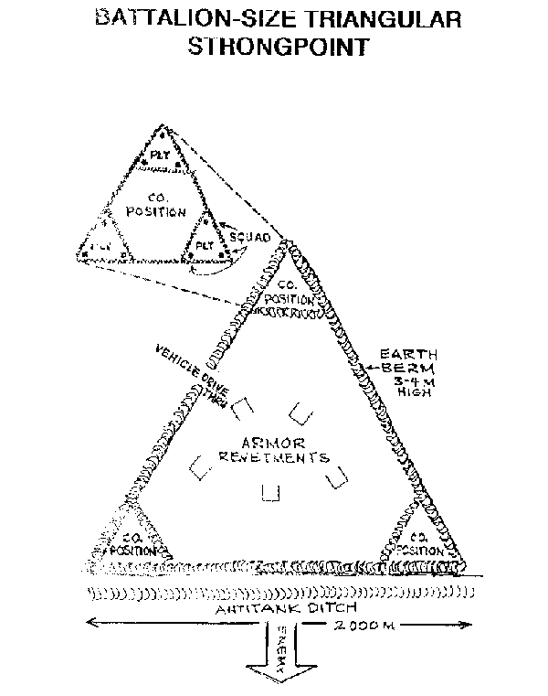
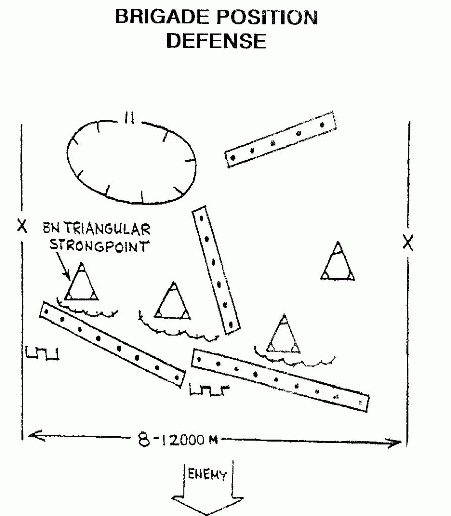
So maybe one battalion per large triangle, every about 4km of front, a double line of battalions so dispersed, is about right. This has been in fact confirmed by the diagrams below, which I added after posting this link on TMP.
Then all support battalions, reserves and so on may have been positioned in the round or rectangular berms that may be spotted here and there.
Firing positions for vehicles and artillery batteries may also be identified. Usually artillery batteries have 6 firing positions.
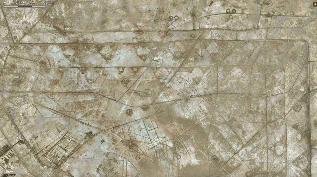
A contemporary satellite view of the defences on the Iraqi border, near Basra. 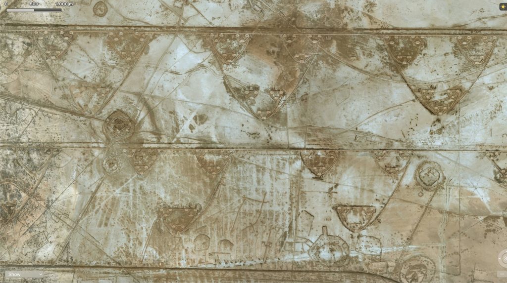
Two lines of triangular fortifications may be clearly seen. Other circular defences might be armor staging areas. 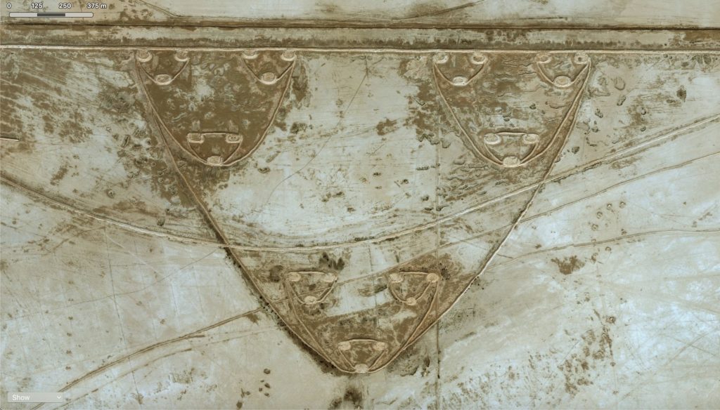
Given the size of this fortification, tiny triangles (platoons) of about 250m size, small triangles (companies) of about 250+200+250m=700m side and a larger triangle of about 700+600+700m=2km, it all might have held three companies from one infantry battalion. 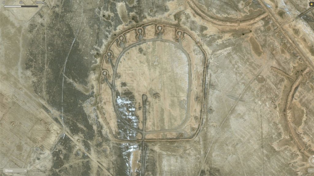
Artillery battery position? 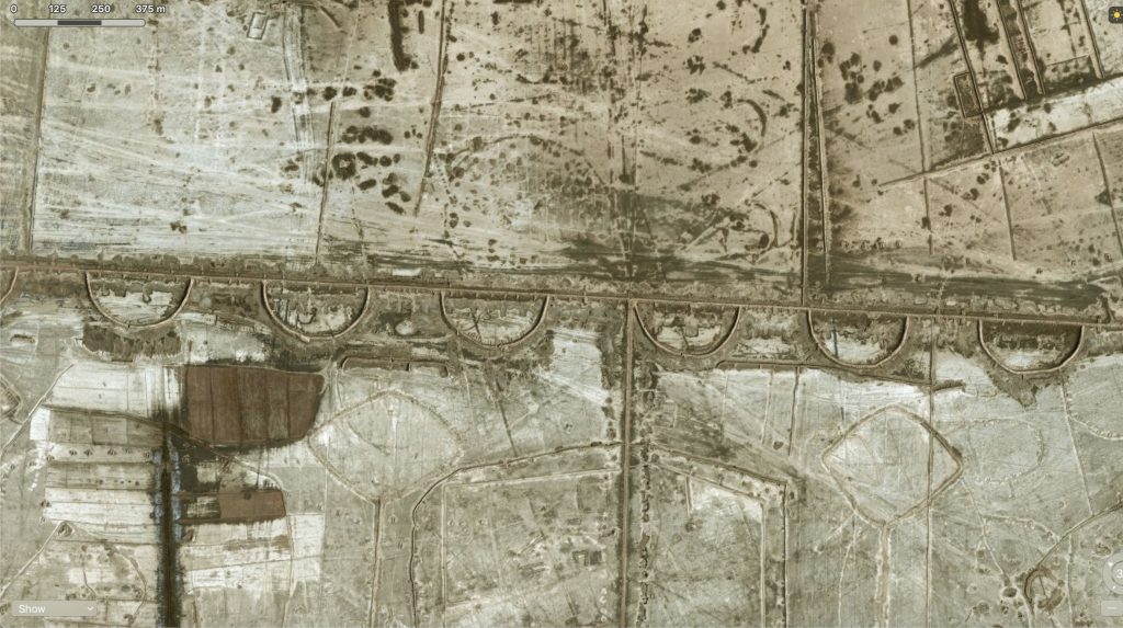
A different kind of linear fortification. Looking at the satellite map and the sketch above, these fortifications were the third line of fortifications just behind the canal. Each semi-circle has 300m diameter and they are spaced by 200m. 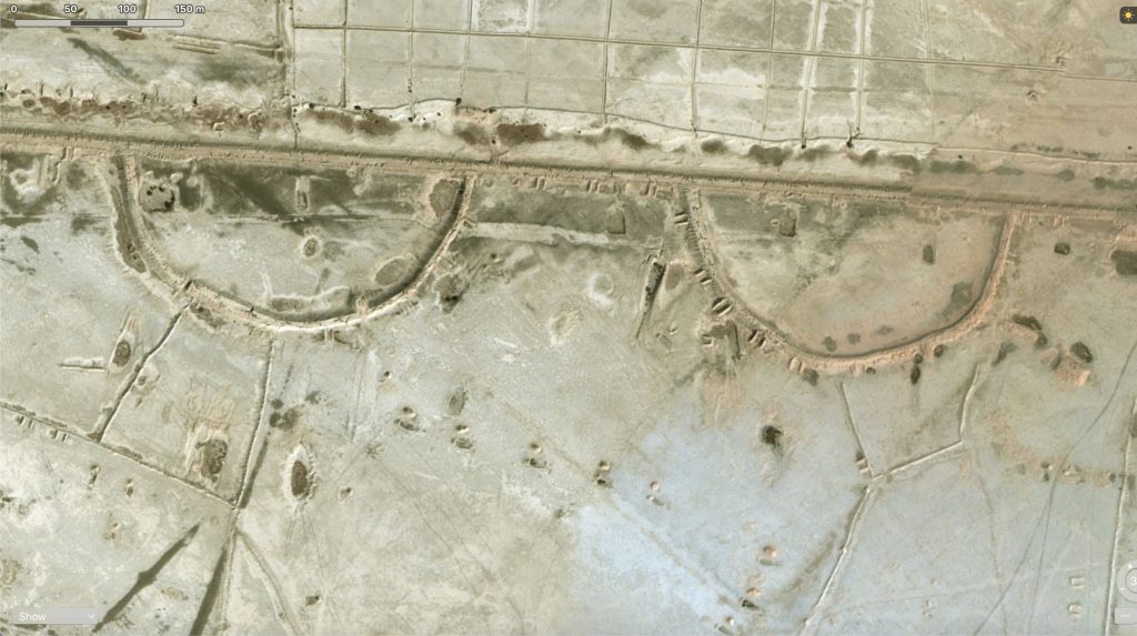
Each semicircle is defended by one infantry company? Platoon size vehicle firing positions may also be seen in between. 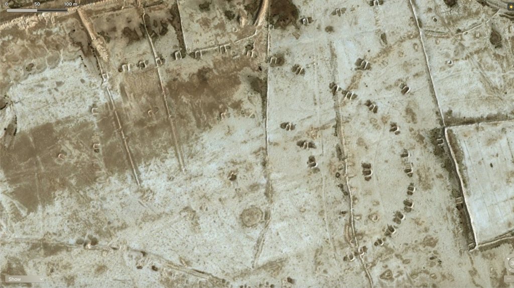
Stage area for an armoured unit? Battalion sized?
Next step will be to adapt these shapes to the Spearhead scale and figures, which are normally mounted on 3cm square bases, one base representing a platoon.
From “The Miniatures Page” I was suggested by ScoutJock (thank you!) a link to globalsecurity.org, where Iraqi battalion and brigade defence works diagrams are shown.
Antitank ditches at about 100mm and up to 350m deep AT and AI mines may be deployed in front of the strongpoint.
One ditch is present on each of the two successive defence lines.
