 Under a bright September sun and a glorious, near perfect temperature, we advanced out of the museum and towards the battlefield. The year-long drought had parched the fields of any sort of green, and the baked, rock-hard ground was anything like the conditions at the battle. Still, we hoofed it towards Bushong Farm.
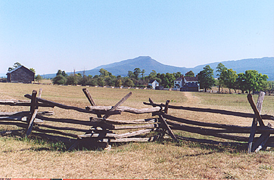
A view from the Hall of Valor looking roughly north towards Bushong Farm. The main battle was further north just beyond the wood lines.
Although the original Confederate line was behind us, the advance pushed it up to and around the Bushong Farm, which is part of the VMI property. The farm itself contains the main house ad a number of outbuildings. The house is closed, but some of the buildings, most empty, are open. You have to remember that the actual battlefield in 1864 extended to the right across the highway and then some. Having the highway bisect the battlefield tends to give you a little tunnel vision.
There's not a heckuva lot of places they could have moved the highway, other than perhaps on the east side of town, although that would entail a loop. The western border of the battlefield rests on a cliff of about 100 feet or so straight down to the river. The eastern border rested on the creek. I-81 sits about halfway or so between the two.
 In any case, we walked through the Farm and its outbuildings, to arrive at a fenceline. Ahead was the Field of Lost Shoes. Before we crossed that, we hung a right and walked to the front of the Farm, and then through a tunnel walkway that runs underneath I-81 and conects to the eastern part of the battlefield.
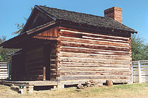
The Kitchen outbuiling at the Farm.
It also leads to a cow pasture with many fresh patties and a number of cows between us and the memorial. Having dealt with cows, sheep, and other battlefields turned private pastures, I've learned not to work that hard looking where I was placing my feet. We headed back under the highway.
 We advanced across the Field of Lost Shoes, pounding across the ground that stood as hard as pavement, until we topped the small rise that served as the Union line. A couple of cannons mark the spot. The actual cracking of the Union flank began on ground that is now the highway. This is no place to relive a flank attack. So we turned and headed west paralleling the Union line.
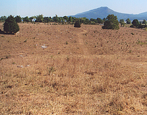
After crossing underneath the highway, we arrived at the tree line on the eastern side of the battle, roughly where the 62nd, 22nd, and 23rd Virginia regiments attacked.
This small hill is the highest point on the preserved battlefield. No more than a dozen yards further west is the cliff. A short wooded path follows the edge, leading back towards the museum and to an overlook. Houses dot the landscape across the river.
With that, we returned to the museum for a quick look at the bookstore. It's well stocked for its size. I picked up a couple of inexpensive booklets about the Battle. And with that, we exited the museum and headed into town.
More Battle of New Market: 1864
Back to List of Battlefields
Back to Travel Master List
Back to MagWeb Master List of Magazines
© Copyright 2003 by Coalition Web, Inc.
This article appears in MagWeb (Magazine Web) on the Internet World Wide Web.
Other articles concerning military history and related topics are available at http://www.magweb.com