
 ĹOne of the most remarkable and unlikely claims ever advanced by the Third Reich was its claim to ĹNeuschwabenlandĺ situated along the Queen Maud Coast in Antarctica.
It was Erich von Drygalski who led the first major German expedition to Antarctica in 1902. During the years 1902 and 1903 this expedition discovered more than 600 miles of heretofore uncharted coastline. The expeditionĺs vessel, the GAUSS, named after the German scientist Karl Gauss who investigated electro-magnetism and the concept of the Magnetic Pole in the 1830s, spent more than eight months trapped in the polar ice before sailing home to Germany.
The next German expedition to Antarctica was led by Wilhelm Filcher in 1911 and 1912. This scientific expedition sailed aboard the DEUTSCHLAND and discovered many new Antarctic featured including the Filcher Ice Shelf. It failed in its goal to cross the Weddall Sea and reach the Ross Sea.
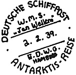
There was a great expansion of German activity in the Antarctic in the 1930s but it was not in the area of scientific investigation. A large German whaling fleet was deployed in the 1930s in Antarctic waters. Some of these vessels had mail canceling services and it is possible to find material used from these ships as seen here.
The Third Reich sent only one expedition to Antarctica and that was in 1938. The activities of this group together with the explorations of earlier expeditions to Antarctica were the basis of the Third Reich territorial claim. The German Antarctica Expedition aerially photographed an extensive segment of the Princess Astrid and Princess Martha coasts of western Queen Maud Land dropping spearlike shafts with emblazoned swastikas to the ice sheet, and mounting shore parties to raise the flag of the Third Reich. The expeditionĺs geographer declared the territory Ĺa German colonyĺ that would be settled according to Ĺthe economic interests of Greater Germanyĺ. Germany named this territory ĹNeuschwabenlandĺ and the German press spoke glowingly about imminent formal claims. It is located approximately 20 degrees W to 15 degrees E of the Greenwich Meridian.
Two seaplanes which did the aerial photography for the expedition were launched from the SCHWABENLAND. This was a Lufthansa flight support ship that had been previously stationed in the South Atlantic to facilitate Trans-Atlantic transportation and mail service. The ship was equipped with flying boats and catapults to launch seaplanes, as well as with cranes so that incoming seaplanes could be lifted on board, serviced, refueled and placed on catapults ready for the next flight.
In this way Lufthansa had maintained the trans-South Atlantic crossing from Bathhurst in the Gambia, to Natal in Brazil with eight-ton flying boats which could not traverse the 2,200 kilometer distance without refueling.
The German Antarctic Expedition was led by Dr. Alfred Ritscher and personally sponsored by Reichmarshall Hermann G÷ring. In little more than three weeks the expedition flew over and photographed more than 135,000 square miles of territory. Alarmed and angered by this incursion, Norway, by way of a proclamation by King Haakon VII and Norwegian Order of Council dated January 14, 1939 officially laid claim to Queen Maud Land (20 degrees West to 45 degrees East). Three days later Germany formally claimed ĹNeuschwabenlandĺ and this led to a diplomatic dispute between the two countries in 1939.
The specter of the Third Reich in Antarctica led to varied responses by nations. The four other nations with formal claims in Antarctica - Britain, France, New Zealand and Australia - immediately supported Norway. The Soviet Union protested the incursion of Peter I Island in queen Maud Land. Germany ignored everyone and acquired ĹNeuschwabenlandĺ indirectly through the invasion of Norway on April 9, 1940.
There was considerable concern by the Allies when World War II had begun that the German Antarctic Expedition, whose personnel were drawn from Air Force and Navy ranks, had been more interested in the use that might be made of hydrographical and meteorological observations for future Antarctic-based wartime raiders than in geographical discovery for its own sake.
The concern was soon justified. The Germans based a small fleet of raiders in remote coves off ĹNeuschwabenlandĺ and the Antarctic islands from which they launched attacks on shipping in the South Atlantic. One frigate, the PINQUIN, managed to capture the entire Norwegian whaling fleet and sink over 136,000 tons of British shipping before she herself was sent to the bottom in 1941.ö
HARRYĺS NOTE - we have photos of the huge flying boats that flew with the support of the ship SCHWABENLAND as well as photos of the ship herself; charts & other photos of the land itself which we will run in issues after DON ANGELĺs story ends. Youĺll see why. There may have been more here than Miskevich realized - a LOT more!
H. KEITH THOMPSON was Adjutant with the huge Byrd Expedition to Antarctica in the 1950s, called Operation ĹHIGH JUMPĺ, alleged to be just a geographical and mapping expedition - - just like the Germans in the 1930s.
Back to KTB #116 Table of Contents
Back to KTB List of Issues
Back to MagWeb Master Magazine List
© Copyright 1995 by Harry Cooper, Sharkhunters International, Inc.
This article appears in MagWeb (Magazine Web) on the Internet World Wide Web. Other military history articles and gaming articles are available at http://www.magweb.com
Sharkhunters International, Inc., PO Box 1539, Hernando, FL 34442, ph: 352-637-2917, fax: 352-637-6289, e-m: sharkhunters@hitter.net