 Today is 26 November, and Michael and I are doing a driving tour of the Wilderness and
Spotsylvania Court House battlefields. It is another cool and sunny day.
I recommend a stop at Chancellorsville visitors’ centre to get information as Wilderness and Spotsylvania have only exhibits and plaques. This was a fact that I learned only after the tour was concluded and we were back at Michael’s home for the night. Fortunately, Michael and I planned to return to the area in the near future to tour Chancellorsville.
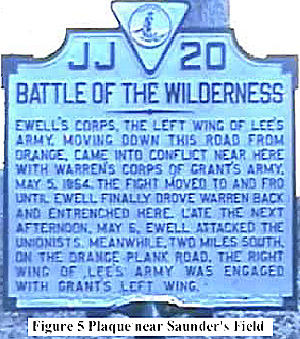
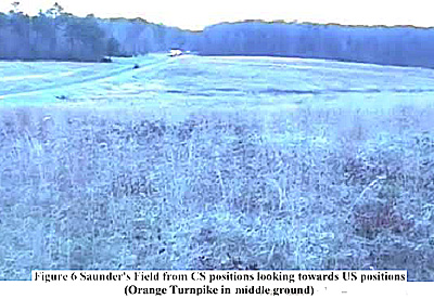
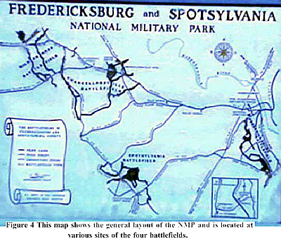
Our first stop was battlefield exhibit shelter (Tour Stop 10 of the Fredericksburg and Spotsylvania National Military Park tour) along the Orange Turnpike (Route #20) at Saunder’s Field. Here are displayed several informative posters and a map of the battle.
We read all of the material presented at this stop and then drove along #20 to the turn-off for the battlefield road, which follows the CS trenches to Orange Plank Road (Route #621). The first road was used by CS General RS Ewell’s Second Corps and the second by CS General AP Hill’s Third Corps prior to the initial clashes with the US Army of the Potomac at Saunder’s Field. The connecting park road (Hill-Ewell Drive) allows the visitor to stop at the various sites that mark the gradual spread of fighting from Saunder’s Field to the south and Orange Plank Road. This covers the ground fought over on the first day of the battle (5 May 1864). Of note, it is still possible to see the CS trenches, which have been worn down to sections of long, low mounds of earth.
 We made our way slowly down the park road stopping to view the many markers that
identified the forces involved at these spots. We also saw Higgerson Farm, Chewning
Farm and the Widow Tapp’s house located behind the CS forward lines. This gave us a
good view of the flora that gives the area its name (Wilderness) as most of the battlefield
was and still is covered by dense tangles of trees and other vegetation. Having trained as
an infantry officer in similar terrain, I appreciated the problems faced by the soldiers
trying to move over the territory of which one soldier described as “a great dismal forest”
with visibility limited to “barley ten paces” (about ten yards).
Our last stop (Tour Stop #11) was at the intersection of #621 and the park road where there is a statue marking the spot where CS General RE Lee was ordered back by his men to avoid the possibility of becoming a casualty (as did happen to Longstreet near the same point later in the battle) during the early hours of the second day’s fighting. Later the same day, CS General J Longstreet and the First Corps arrived along the Orange Plank Road and forced a timely withdrawal of the attacking US forces. Here we got out and walked through the open field along the path that leads to the Widow Tapp Farm.
There are several information plaques on this ground describing the actions of 5-6 May and cannons marking where CS batteries were positioned (cannons are placed at such sites to mark battery locations at all of the military parks, and thus are good vantage points).
 We then drove to the intersection of #621 and #613 (Brock Road), identified as Tour Stop
#12. Here we turned onto #613 and followed the movements of the two opposing armies
to Spotsylvania Court House. We made one stop along the way at Todd’s Tavern, where
clashes occurred between elements of the two armies. Our next stop was the exhibit
shelter (Tour Stop #13) for the Spotsylvania CH battlefield. Again we paused long
enough to read the descriptions on the posters and maps depicting the highlights of this
battle.
We drove along the “Mule Shoe Salient” as the CS defensive line was identified and this includes the “Bloody Angle” site of the bloodiest fighting of the battle (Tour Stops #14- 16). The ground in front of the angle is open and should have been a “killing ground” except for fog and wet CS powder. Just another example of the frustrations and advantages encountered by soldiers in battle. Some of the defensive positions are preserved particularly the “Bloody Angle” and the contiguous line around the tip of the salient.
The next stop was the second defensive position built by the CS forces closer to the Court House along Brock Road. This line was much better constructed and was not attacked with any enthusiasm by the US Army of the Potomac. From there we left the park and drove to a local restaurant for lunch (we had spent over three hours touring the two battlefields and were now “a tad peckish”), and then back home. Of note, the US forces lost another senior officer, US General J Sedgewick, who was shot by a CS sharpshooter on 9 May. Apparently he had recently commented to some US infantry that the CS troops “couldn’t hit an elephant at this distance”. Another rash example of tempting fate!
The two armies were to meet next at North Anna River, which will be the subject of a later article when Michael and I continue our tour of Virginian battlefields, possibly in the spring of 2004.
Back to Sabretache # 6 Table of Contents
Back to Sabretache List of Issues
Back to MagWeb Master Magazine List
© Copyright 2003 by Terry Gore
This article appears in MagWeb.com (Magazine Web) on the Internet World Wide Web. Other articles from military history and related magazines are available at http://www.magweb.com