 Today is 2 December and it proves to be another cool but sunny day. Allie woke me at
0730 hours for her morning walk. This is earlier than my usual rising time (0800) but not
enough for me to grumble.
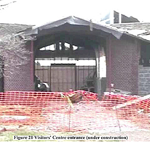
After breakfast, we drove to the park and stopped at the temporary visitors’ centre about 0945. The permanent centre was undergoing considerable expansion work and will open again in spring 2004. The building will be significantly larger with more exhibits and a larger bookstore.
Elaine Gallenby, who is the site supervisor for Eastern National, greeted me, and started the park movie that covers the battle and also has a demonstration of artillerymen firing a cannon (artillery section). Both US and CS crews were shown going through the drill procedures for firing a 12-pound Napoleon. Later she processed my application for membership in EN. The EN representatives at the parks do not normally do this; however, Elaine decided to accommodate me and got me enrolled without filling in an application. She arranged for my membership card to be sent to my hotel in Jackson, Mississippi (where I planned to stay so that I could visit Vicksburg and its environs). Elaine also helped me to select items in the bookshop including two books on the battle.
 Of note, EN provides educational products and services to the national parks and other
public trusts. It has an on-line bookstore at www.eParks.com. Membership includes a
discount at the bookstores of the parks and other services. I bought many of the booklets
published by EN for the national battlefield parks that give a good account of the battles.
These supplement the tour brochures of the parks.
Afterwards, I browsed through the books and other souvenirs. I collected my map of the park and an audiocassette for a self-guided tour. This covers the complete park with additional points of interest such as the HQ of the opposing generals, Rosecrans and Bragg, and Fortress Rosecrans.
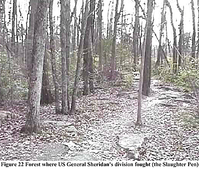
I did the main part of the tour first and that covers the area of the battlefield where the heaviest fighting occurred. I saw the “Slaughter Pen” where US Generals P Sheridan’s and Negley’s divisions held the ground and slowed the assault of the CS right wing. Their defence was crucial as it allowed Rosecrans to shift his troops concentrated on the US left flank to the centre near the “Round Forest” and along the Old Nashville Turnpike.
 The next stop was the “Cotton Field” across which the remnants of US General
McCook’s corps retreated and rallied behind the new defensive positions along the
turnpike. The CS troops attempted to breach the new defences by repeatedly charging
across the open field, unfortunately with no success. The field is still devoid of trees and
bordered with split rail fencing. Cannons mark the position of the Chicago Board of
Trade Battery (financed by the Board of Trade), which fired upon the advancing CS
forces exiting the woods about 800 yards to the battery’s front. Later a second US battery
joined in the cannonade of the CS troops.
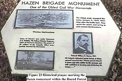
After collecting my books and other purchases, I left the main park area and drove along to the “Round Forest” and the Hazen Monument. The latter is one of the oldest ACW monuments as it was erected in 1863 by survivors of US Colonel Hazen’s brigade that held the tip of the V-shaped US defensive line. There are headstones marking the dead of this brigade around the monument. This is a clear marker for the “Round Forest” which no longer has its distinctive shape. From this position it is possible to see the location of the Cowan House, which was destroyed prior to the battle (but still delayed the advance of two CS brigades). The house stood on ground now hosting the overpass bridge of Thompson Lane (#268) where it crosses the old turnpike.
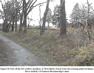
 The last stop was just off Thompson Lane at McFadden’s Ford on the Stones River. Here
there is a tall obelisk marking the ground where the US artillery concentrated to defeat
the assault by CS General (and former VP) J Breckenridge’s division on the third day of
the battle (2 January 1863). About 1800 of Breckenridge’s troops became casualties as a
result of the heavy US artillery fire. The Murfreesboro Greenway System (a local
program that preserves land in and around Murfreesboro) has a path along the river’s
west bank and one can walk along from McFadden’s Ford to Bragg’s HQ. From the path
can be seen Harker’s Crossing and Wayne’s Hill, the former is near the Hazen monument
and the latter was used by CS artillery to bombard the “Round Forest”. This section of
the path is roughly the other side of the V-shaped US defensive line. Further along the
path is Bragg’s HQ roughly halfway between the park and Fortress Rosecrans. The trail
from McFadden’s Ford to Fortress Rosecrans is about three miles long.
From the artillery obelisk, I drove to the golf course that now occupies Fortress Rosecrans. This was built by Rosecran’s army following the battle and encompassed 200 acres around which was a 14,000-foot earthen wall and ditch. It was the largest earthen fortification constructed during the war. It was used as a supply depot for the later campaigns of the US armies in Tennessee and Georgia. All that remains of the fortress is a 3,000-foot section (Lunette Palmer, Curtain Wall #2 and Lunette Thomas) and one of the four redoubts, Redoubt Brannan.
Murfreesboro was threatened thrice by CS cavalry forces:
- 1. CS General JH Morgan fought the troops of the US garrison at Vaught’s Hill
(Milton) located 15 miles to the northeast in March 1863;
2. CS cavalry raided the area south of the town in October 1864; and
3. CS General NB Forrest clashed with the garrison in the Battle of the Cedars on ground within the battlefield of Stones River (along the Wilkinson Pike that forms the southern boundary of the main park area) on 7 December 1864.
The garrison also participated in the Battle of Hoover’s Gap on 24 June 1863, which is about 18 miles southeast of the fortress.
One other major battle was fought in the vicinity, that of Franklin on November 1864. It was a costly (pyhrric) victory for CS General JB Hood during the last campaign of the Army of Tennessee within the state. After its defeat at Nashville, the army withdrew to Mississippi, a mere shadow of its former self.
The stop at the fortress concluded my visit and I drove down Interstate 24 to Chattanooga for the night. I was basically following the same route as used by the two armies after the battle. I crossed the Duck River, which was defended by the CS Army of Tennessee until outflanked by the US Army of the Cumberland after Stones River. The route followed by I-24 was similar to the direction used by the CS forces to withdraw to the Tennessee River and Chattanooga.
Back to Sabretache # 6 Table of Contents
Back to Sabretache List of Issues
Back to MagWeb Master Magazine List
© Copyright 2003 by Terry Gore
This article appears in MagWeb.com (Magazine Web) on the Internet World Wide Web. Other articles from military history and related magazines are available at http://www.magweb.com