 The Shenandoah Valley has a lot of different locations for the ACW buff. Trying to
decide what to visit can be daunting. Since this was my first visit, I decided to focus on
Front Royal and New Market. Winchester was the site of three battles and Kernstown,
just to the south, “hosted” two battles. My choices were smaller towns with simple
routes to follow in order to trace the flow of the battle.
At right, New Market Battlefield, one of the sites in the Shenandoah Valley
The weather was cool and cloudy with plenty of sunny breaks throughout the day. Front Royal is located south-east of Winchester and is a good starting point for the Shenandoah National Park. The town was important to CS General TJ “Stonewall” Jackson as it allowed him to flank the US army of General NP Banks located at Strasburg. Jackson advanced to the town via New Market and Luray, and I drove along this route from Front Royal. The Battle of Front Royal (23 May 1862) was followed by the First Battle of Winchester (25 May 1862). Jackson’s movements allowed his army to first flank a superior enemy army and then threaten its rear such that Banks had to withdraw from Strasburg to defend Winchester.
I took Highway 340 into the town, which allowed me to start at the end of the battle at Cedarville (Tour Stop #10). The highway then crosses over the north fork of the Shenandoah River. Near the highway bridge over the river, one can see Guard Hill (Stop #9), which was the last defensive line of US Colonel JR Kenly’s garrison before retreating towards Cedarville and Winchester. I then crossed the south fork of the Shenandoah near the former turnpike and railway bridges that were ordered burned by Kenly (Stop #8). It is a short drive along 340 to Richardson’s Hill (Stop #7), where Kenly made his stand (1415 to 1615 hours). Kenly then had to retire as Confederate cavalry between the two forks of the river flanked his position. Rose Hill (Stop #6) is next along 340 and it is here that the CS 1 st Maryland and 1 st Louisiana Special (Wheat’s Tigers) Battalion came under artillery and infantry fire from Richardson’s Hill.
The highway continues to the courthouse (Stop #4) and beyond; however, I turned left and drove to the visitor’s centre located in the former railway station. Here I stopped to purchase a copy of “Brother Against Brother”, which was published by the Battle of Front Royal Committee. It contains reproductions of all the plaques located at the tour stops and supplemental text, photographs, pictures and maps relating to the battle. The title denotes the conflict between the CS and US 1st Maryland Infantry Regiments that occurred throughout the battle as the two units were in the forefront of their respective armies.
From the visitor’s centre, I drove back to the courthouse and along 340 to see Prospect Hill Cemetery (Stop #3), Belle Boyd (Stop #2) and Asbury Chapel (Stop #1). Belle Boyd informed Jackson of the US garrison at #2, where the CS forces were deploying for their advance into Front Royal. Asbury Chapel is located on #340 (formerly Luray-Front Royal Turnpike) and marks the general location where Jackson decided how best to move into Front Royal.
I decided not to follow Highway 340, but rather enter the north entrance of the Shenandoah National Park and take the “Skyline Drive” to Luray. My National Park annual pass gained me entry to the park without the need to pay the $10 fee. The clouds were thinning as I began the drive to Luray so the various scenic/panoramic lookouts were most impressive both into the valley and east towards the rest of central Virginia.
This route parallels #340 so I was able to follow Jackson’s movements from well above the valley (2000 to 3000 feet high in most places). The south fork of the Shenandoah River can be seen from here as well as Massanutten Mountain to the west.
At Luray, I turned on to Highway 211 and headed to New Market by way of Massanutten Mountain. The drive gave me a good view of the eastern valley and the panoramic views from Massanutten.
 The Virginia Military Institute (VMI or West Point of the south) museum and battlefield
park are easy to locate on the west side of New Market as the Interstate 81 divides the
battlefield. I drove to the museum parking lot to begin my tour. By now (about 1400
hours), it was sunny with only a few clouds.
The museum is a state run facility so I did have to pay the fee with a discount, as I am a veteran (25% off). The building is divided into two parts:
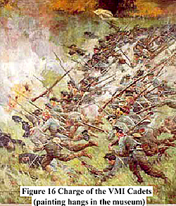
- The first covers the history of the VMI and the role played by the cadet corps (about 250 cadets aged 15-19 years) in the battle. The highlight is the Emmy Award movie “Field of Lost Shoes” that covers the battle as a re-enactment from the cadets’ point of view. Several of the prominent cadets are portrayed such as Thomas Jefferson and his friend, Moses Ezekiel, the first Jewish cadet. Jefferson died of his wounds after the battle, while Ezekiel tended to him. Of interest, Ezekiel became a well known sculptor and settled in Italy; and
- 2. The second is a general museum of the ACW with two floors of exhibits including a large three-dimensional model of the valley.
Allie and I followed the self-guided tour outlined in the book that I bought in the gift shop of the museum. The park encompasses most of the battlefield so it is easy to trace the progress of the battle. The battlefield is between the bluffs overlooking the north fork of the Shenandoah River and Smith Creek to the east. The drop to the Shenandoah is quite steep so it was very much a deterrent to any attempt to outflank on the western boundary.
The first major stop beyond the museum is the Bushong Farm. The buildings have been preserved with the house divided into several exhibit rooms, the barn housing a workshop (the Bushongs made wheels for the local wagons), and washrooms in another building.
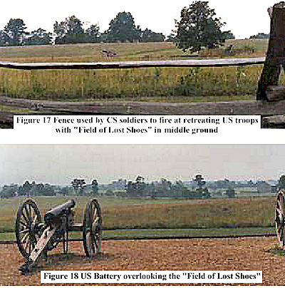
The trail continues to the wood fence from which the CS troops fired upon the US soldiers retiring to Sigel’s Hill and Von Kleiser’s battery across the open field later dubbed “the Field of Lost Shoes” because of the many shoes left behind by the VMI cadets as they advanced to the US defensive line (Sigel’s Hill to the 54 th Pennsylvania Monument).
Allie and trudged across the field, which is lower than the surrounding land thus a natural repository for ground water. We stopped at Von Kleiser’s battery for a look back down to the farm, and then climbed up to Sigel’s Hill. Both positions and the ground in between would have been ideal for plunging fire into the advancing CS units. Despite this, the VMI cadets and other units swept the US troops and pursued them towards Strasburg.
From the top of Sigel’s Hill, we backtracked to the Bushong Farm and used the tunnel under Interstate 81 to traverse the rolling terrain up to the 54 th monument. Over this ground US General J Stahel’s cavalry attempted a charge, which was repulsed.
My own assessment of the ground suggested that it was not suited for cavalry as the two armies stood on high ground separated by a deep and narrow valley with trees scattered about on the edges of the cultivated fields.
One highpoint for the US army was the rear guard action by Dupont’s battery, which covered the retreat using “echelon by platoons” meaning the cannons were fired and retired in a leapfrog series of movements. This is not something usually done by artillery after a battle.
From the park, I headed to Charlestown, WV for the night. It was a long drive through the mountains, which were covered with snow. The temperature dropped to about 25F, the coldest weather that I had experienced since leaving Canada the previous week.
Back to Sabretache # 6 Table of Contents
Back to Sabretache List of Issues
Back to MagWeb Master Magazine List
© Copyright 2003 by Terry Gore
This article appears in MagWeb.com (Magazine Web) on the Internet World Wide Web. Other articles from military history and related magazines are available at http://www.magweb.com