 Today is 24 November, and my good friend and fellow ACW buff, Michael McGinnis
and I drove to Fredericksburg, Va. The temperature for much of the day was above 70 F,
which is unseasonably high for November. This is the first of three battlefields that
Michael and I planned to tour. He lives in northern Virginia and many battlefields of the
Armies of Northern Virginia and the Potomac are within striking distance for one-day
tours.
Our tour started at the Fredericksburg tourist centre located on the main street of the old town just a few blocks from the Potomac River. Here we collected some pamphlets about the old town and a map showing the pontoon sites and general area of the initial fighting before the CS troops withdrew to the heights south of the town.
We walked down to the first pontoon site and through the streets looking for battle damage on the wartime buildings. This was a short tour because the waterfront combat zone is small compared to the modern town waterfront. Still it was enjoyable as there were few people about and even fewer tourists.
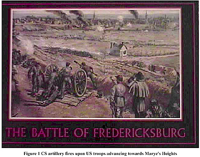
The next stop was the park entrance, and lunch at the restaurant across from the park’s visitors centre. A tour of the centre and a viewing of the documentary film (narrated by James Earl Jones) followed. Unfortunately, the upper portion of the park, Prospect Hill (CS General TJ Jackson’s wing), was closed because of the damage inflicted by Hurricane Isabelle, so we restricted our tour to the national military cemetery and sunken road on Marye’s Heights (CS General J Longstreet’s wing). Note that Marye is pronounced as Marie. The sunken road and some of the key buildings along it are well preserved, although the stonewall has been restored to its wartime appearance. This is another short jaunt as newer streets block access to the rest of the battlefield on the western side. Fortunately, the Sunken Road is still in use beyond this point. The cemetery provides a better view of the battlefield as modern houses obscure the view from the Sunken Road. I bought a postcard depicting the fighting on Marye’s Heights that shows the open area over which the US troops advanced.
There was just enough time for a visit to the bookstore located behind the visitors centre before the drive back to Michael’s home. I bought many of the National Park Services books on the battle parks that I planned to visit, some postcards and other souvenirs.
Back to Sabretache # 6 Table of Contents
Back to Sabretache List of Issues
Back to MagWeb Master Magazine List
© Copyright 2003 by Terry Gore
This article appears in MagWeb.com (Magazine Web) on the Internet World Wide Web. Other articles from military history and related magazines are available at http://www.magweb.com