 Another sunny and cool morning (about 55F) greeted me as I walked Allie around the
grounds of the hotel. The weather was good for 1 December and also for driving. Today,
I decided to make a “small” detour to the Cumberland Gap rather than heading down
Interstate 75 to Knoxville, Tn. My aim was to see the gap nicknamed “the Gibraltar of
the West”.
In order to get there, I took Highway 25E, which bisects Interstate 75 at Corbin, Ky. This is the town where (Honorary) Colonel Harlan Sanders had his first restaurant (and motel and gas station). It was just a short detour so Allie and I paid a visit to the museum and purchased a few souvenirs. We sampled some KFC food (Allie liked the popcorn chicken pieces) and headed back to #25E.
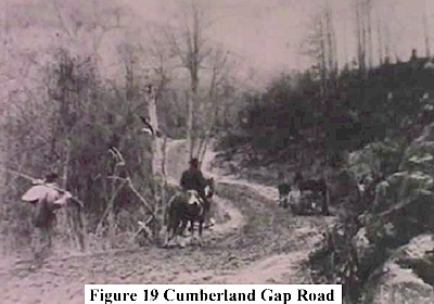
The next stop was the information centre of the Cumberland Gap National Park, which is located at the entrance to the tunnel under the gap. This was constructed in 1996 to replace the old highway through the gap. Since its opening, the old road has been demolished and the gap restored to its former state as Daniel Boone and other settlers knew it in the late 18th and early 19th Centuries.
The centre has a movie about Boone and the gap (about 45 minutes). I watched it and was impressed as much of the panoramic footage was taken in autumn so the multi-coloured leaves stood out from the evergreen trees. The plot is good as it explains the importance of the gap in the settlement of Kentucky. This also helps to understand its significance during the civil war.
Of note, the Cumberland River and later the gap were named in recognition of the Duke of Cumberland, the loser at Fontenoy and victor of Culloden (ironic as the state was settled by many Scots immigrants). The gap was first used by animals, then Indians (Creek and Cherokee) and finally European settlers.
 The Cumberland Gap formed the northern flank of the CS defensive line covering
Eastern Tennessee all the way south to Chattanooga. It was difficult to defend as it could
be easily flanked by US forces as happened several times before the region was finally
occupied by US forces. The population was predominantly pro-Union, which just added
to the many problems faced by CS commanders in defending this flank of the
“Confederate Heartland” (encompassing Kentucky, Tennessee, Mississippi, Alabama and
Georgia).
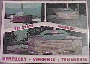
I took the road up to the Pinnacle Overlook, which is part of a hiking trail that allows people to see some of the breath-taking scenery. From this point, the view is wonderful and it is easy to see why people were drawn to this region. There are markers that identify the three states that share the gap: Kentucky, Virginia and Tennessee.
Then it was on to Knoxville and finally Murfreesboro. This was a long drive, but well worth the time after the splendour of the Cumberland Gap. My hotel is only a short distance from the battlefield park and that will be tomorrow’s adventure.
There were many other things to see near the gap such as the Abraham Lincoln Library and Museum in Harrogate, Tennessee. It is two miles from the gap at the entrance to the Lincoln Memorial University, which was founded by US General OO Howard, who fulfilled Lincoln’s desire to reward the people of East Tennessee who remained loyal to the Union during the war. Middlesboro, Ky is home to the mysterious P-38 museum. The plane was recovered from under the ice of Greenland. I do not know the complete story, but it is another interesting feature in this part of Kentucky.
Back to Sabretache # 6 Table of Contents
Back to Sabretache List of Issues
Back to MagWeb Master Magazine List
© Copyright 2003 by Terry Gore
This article appears in MagWeb.com (Magazine Web) on the Internet World Wide Web. Other articles from military history and related magazines are available at http://www.magweb.com