 Today is another cool and overcast day. At higher elevations (atop Lookout Mountain), it
is colder (about 35F) and light snow instead of rain.
The first stop of the day is the museum and bookstore of the Chickamauga Park. I bought some postcards and a park pin after touring the museum wing. I have now purchased several park pins to add to the collection on the UN blue band of my Akubra (Australian) hat. (A member of the Australian police contingent presented the blue band to me in Cyprus). My last stop was to speak with one of the rangers at the main desk. He gave me directions to Missionary Ridge and Lookout Mountain. I also encountered some of the British officers continuing their studies of the battle inside the museum.
With the map on my lap and Allie in the navigator’s seat, we set off for Crest Rd and the
drive along Missionary Ridge. In the Rossville Gap, the entrance is easy to identify as
there is a large pillar (an Ohio monument) marking the start of Crest Rd. From here, the
road follows the ridgeline to Sherman Reservation. I made stops at Bragg’s HQ, Turchin
Reservation, Delong Reservation and finally Sherman’s above the railway tunnel through
the ridge.
 Most of the land is private property except for the places that I mentioned.
The various positions of the opposing forces are marked with a series of blue (US) and
red (CS) plaques the same as those I saw in the Chickamauga Park yesterday. These are
situated where the attackers and defenders were positioned during the final assault along
the ridge.
The next part of the route takes one into Chattanooga to Orchard Knob, which rises from the surrounding land and provides a good vantage point from which to see Missionary Ridge. This is where US General US Grant commanded the advance of his combined armies during the assault on Missionary Ridge.
I had lunch on the outskirts of the city before tackling the last area of the park, Lookout Mountain. I ate at Krystal (www.krystal.com), a burger chain known for its bite size hamburgers and hotdogs. It was my first experience in many years of eating mini-burgers.
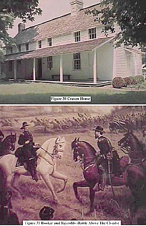
Then it was on to Lookout Mountain. I drove first to Craven House, which is about the
halfway point up the slope to Point Park. I stopped briefly to look at the grounds, but did
not take any video footage as the area was shrouded in fog. Finally, I reached the NP
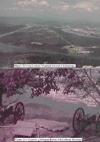
station at the entrance to Point Park. This offers a good panoramic view of Lookout
Valley, the Tennessee River and Chattanooga. As it was very foggy and a light snow was
falling, I decided to look around the museum. The display of note is the painting by W.
Walker, who was the most famous of the Civil War era military artists. His “Battle
Above the Clouds” captures the attacks by US General J Hooker’s XIV Corps from a
vantage point in Lookout Valley. The central figures are Hooker on his white horse and
his artillery commander, Major Reynolds. Walker was there during the battle and
returned in 1864 to make sketches for several paintings.
 I also went next door to see the large diorama of the “Battles for Chattanooga”. This is a
private production, which takes the viewer through the chronology of the campaign
following the Battle of Chickamauga. Using a 3-D model covered with the various
points of interest, military miniatures and lights, a narrated sound and light show has been
produced and it is quite entertaining. The vantage point is north of the city near where
US General WT Sherman’s troops crossed the river to assault Tunnel Hill and Missionary
Ridge. All of the natural features mentioned above are clearly shown. The store sells a
mix of souvenirs, books, movies and other items. I bought a tall shooter glass to give to a
friend. It is divided into sections from Private to General with the latter at the top.
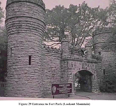
From here, I picked up Allie and my video camera from the Jeep, and entered the imposing entrance to the park. I was fortunate because the visibility had improved and the snow had stopped. I walked down to the many vantage points and then Ochs Museum for a magnificent view of the surrounding area. This is close to the rocks from which CS Generals Longstreet and Bragg planned the poorly executed attack on Hooker’s men on 28 October 1863. US Generals Grant and Hooker also posed there for photographs following the successful US capture of the mountain. From here, it is possible to hike down to the Craven House and to other vantage points. Since the path was wet and I was alone, I decided to end my tour and go back to the parking lot.
My last stop was to the visitors’ centre to get directions to Shiloh from one of the park rangers. This will be tomorrow’s destination so that I can tour the battlefield park in the afternoon, and then drive to Memphis for the night.
Back to Sabretache # 6 Table of Contents
Back to Sabretache List of Issues
Back to MagWeb Master Magazine List
© Copyright 2003 by Terry Gore
This article appears in MagWeb.com (Magazine Web) on the Internet World Wide Web. Other articles from military history and related magazines are available at http://www.magweb.com