Salut from hex 17A: 1605, I would like to propose some modifications on maps 16A, 17A, 26 and 27. Most are made from my direct personal observation of the locations.
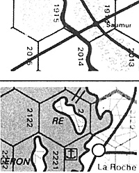
AD: I have noticed some errors on the map 17A, as I personally seen these locations.
Saumur: the point city is in 2014 and not in 1914
JMA: You are correct; it appears the rail junction in 1914 proved irresistible and Saumur jumped the Loire River to be there! 2014 is the right spot for Saumur.
AD: Ile de Re: the narrow strait should be in 2121/2220 and not in 2020/2121.
JMA: Again, this is correct; the narrowest straits (and ferry) go from La Rochelle to Re. Fortunately, misplacing the narrowest straits crossing a hexside will be unlikely to have any appreciable impact on play.
AD: Brest: the narrow strait should be in 0622/0522 and not in 0622/0523.
JMA: This is more of a judgment call, as the narrow straits -fall right on the 5022/0523 hexside. We chose 0523, but you can certainly make a case for 0522.
AD: 17A:0715 should be a restricted waters hex representing Plateau des Minquiers.
JMA: Unlike the nearby Goodwin banks (16A:0532), the Plateau des Minquiers is not quite extensive enough to make the entire hex restricted waters. I suppose we could have a hexside or two of restricted waters here, but I think we need not proliferate terrain types for this! Besides, Winston has declared "no pasaran" (they shall not pass) for new terrain types (or unit types) unless there is an overriding reason for them.
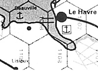
AD: 17A: 1007/1108 should be a narrow straits hexside representing Bac de Berville.
JMA: The geography around Le Havre was adjusted slightly from how it mapped to the hex grid, as otherwise ground operations in the area would have been artificially constricted. As part of this adjustment, the narrow straits hexside was moved from 17A: 1007/1108 to 17A: 1007/1008 (as shown on the map), as otherwise Allied naval forces could sail too far up the Seine estuary than was actually possible as long as hexes 1007 and 1008 remained under German control. By the way, 17A:1007/1108 and 17A:1007/1008 should not both be narrow straits, as the actual geographic situation calls for only one narrow straits across the estuary, not two.
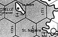
AD: 17A:1322: the full name of the island is "Belle-ile" and not "Belle" alone.
JMA: As a general rule, Europa drops the word "island" from the names of islands, "river" from the names rivers, etc. Doing this helped reduce map clutter. It also put an end to the debate on whether to translate non-English common place words into English (this is not elegant - for example Belle Island) or to have a plethora of different words all meaning the same thing (island, ile, isla, isola, ilha, insula, insel, eiland, o, oy, ostrovo, saari, ada, ostraf, nisi, and perhaps a few more would appear on the maps just for "island" - certainly confusing and perhaps not really informative!). Thus, Ile de Re is Re and Ile de Noirmoutier is Noirmoutier. Belle-ile became just Belle, although I agree that its name without the "ile" must as sound odd in French as it does when your translate it into English. Had we noticed at the time, we may well have made an exception in this, as we did in Balkan Front Isola Longa, Italian for Long Island.
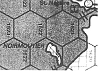
AD: 17A: 1621/1721 is a quasi-unique case. When the tide is high, Noirmoutier is an island. But when the tide is low, a strip of land links Noirmoutier at the continent. And on this strip of land, a road was built. This road functions only when the tide is low. It is not a causeway; it is not a narrow straits; but something between. So, in a very optional rule, I propose to consider this hexside as a minor river for movement and as a major river for combat.
JMA: A very optional rule, I agree.
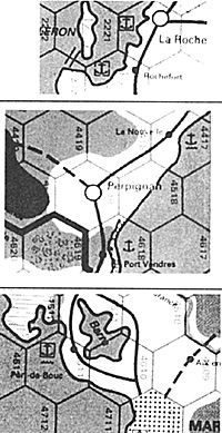
AD: At 17A:2221/2322, the narrow straits linking Oleron and the continent should be 2221/2321.
JMA: I believe the narrow straits was moved from 2221/23 to 2221/2322 to show that a force had to move a considerable distance from Rochefort in order to cross to Ile d'Oleron, a nuance that is lost with 2221/2321 since in this case Rochefort and the narrow straits are both in the same hex.
AD: 17A:4417 and 4518 should be swamp hexes.
JMA: This is indeed possible - it was a judgment call to make them clear, not swamp. There are numerous marshy areas along the coast -like the nearby coastal hexes at the mouth of the Rhone River. I believe that for 4417 and 4518, it was judged that the coastal marshes were not extensive enough and did not reach inland enough to warrant showing the entire hexes as swamp. Actually, you could make a case that Europa could have "coastal swamp" terrain features that work similar to coastal cliffs (they'd affect amphibious landings but not land-only operations in the hex), but even as I write this I hear a small voice calling somewhere, "No pasaran, no pasaran!"
AD: 17A:4611, is a problem: Port-de-Bouc is the end of the railroad from the north. The railroad linking Port-de-Bouc to Marseilles does not exist in 1938 and a canal links the Etang de Berre to the sea. I think that Port-de-Bouc can be moved to 17A:4511, that the 4611/4511 hexside should be a canal hexside without abridge. The railroad from 4611 to Marseille is OK (it is a different railroad).
JMA: Your are correct about Port-de-Bouc in 1938. However, on the other side of the canal a short distance from Port-de-Bouc is Martigues, with a major road connecting it to Marseilles a hex away. (I cannot tell if the railroad in 4611 goes to Martigues or not from the sources I have at hand.) I believe the canal was used to trans-ship some cargo from Port-de-Bouc to Martigues for further shipment by land to Marseilles. If this is the case, then it may have been convenient simply to show a rail line running all the way to Port-de-Bouc via 4611. Perhaps our map researcher will provide more detail here at a later date. As for the canal itself, most French canals were not significant military barriers and thus are not depicted on the maps. I believe the Etang de Berre is not a significant barrier.
AD: And now, tourism on Corsica! At 27:0801, 1 think a minor city should be placed here: Corte is the third city of the island.
JMA: I believe Corte fell below the population size used to qualify point cities.
AD: At 26:0732, I don't exactly know how the artificial harbor status is granted, but I wonder if Bastia should be an artificial harbor. For 27:1203, I don't exactly know how the strong harbor status is granted, but I think Bonifacio must be a strong harbor.
JMA: Perhaps our map researcher will check on these some time.
AD: Finally, I wonder if the following minor ports should be depicted on the Europa scale: 27:1103, Porto Vecchio; 27:0701, Saint Florent; 27:1003, Propriano; 27:0601 or 0602: "L'Ile Rousse." These 4 ports are present on my 1938 Michelin Corsica map.
JMA: I believe these are all ports for local fishing vessels and have little actual capacity beyond this purpose.
Back to Europa Number 59-60 Table of Contents
Back to Europa List of Issues
Back to MagWeb Master Magazine List
© Copyright 1997 by GR/D
This article appears in MagWeb (Magazine Web) on the Internet World Wide Web. Other military history articles and gaming articles are available at http://www.magweb.com