During the Civil War, the roads from Washington to Richmond were awash with blood. It was only natural as two great armies, the Army of the Potomac and the Army of Northern Virginia, contended between their respective capitals.
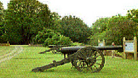
 Heavy guns mounted on Stafford Heights.
In an area less than twenty miles east to west and ten miles north two south, just south of the Rappahannock River, those armies fought four of the costliest battles of the war. Chancellorsville in 1862 marked the greatest moment of Robert E. Lee's career, and the final ones of Stonewall Jackson's life. Fredericksburg, fought the following winter, was another Confederate victory, and was the nadir of the Army of the Potomac. When the armies next clashed near the river, it was the spring of 1864 and the their fortunes were reversed. Lee had lost not just Jackson, but the battle at Gettysburg, and the military situation of the Army of Northern Virginia, and the Confederate States of America, as a whole were in decline. On the other side, a long line of disappointing Union commanders——-McClellan, Burnside, and Hooker——-had given way to Ulysses S. Grant. George Meade, the victor of Gettysburg, would retain command of the Army of the Potomac until the end of the war, but it would be the genius of Grant that animated it on the route to Petersburg ... and Richmond.
Today the battlefields, or more properly large portions of them, are preserved as the Fredericksburg and Spotsylvania National Military Park. That name is deceptive; the National Park Service site incorporates Chancellorsville and Wilderness as well.
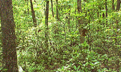
 Why it was called "The Wilderness"
It is large, embracing 7,775 acres in four battlefields and three smaller areas. At the same time however, there are historically important points that are not within park boundaries, most saliently the start of Jackson's decisive attack on the second day of Chancellorsville. Furthermore, although the fords of the Rappahannock, particularly United States Ford and Banks Ford, were of critical importance, all park areas are significantly distant.
Fredericksburg was a sizable town even at the time of its battle, which was fought in its midst. So it should not be surprising that urbanization constrains the boundaries of the park there; after all, the town did come first. Likewise, the built-up nature of the battlefield does not seem nearly as obnoxious as Gettysburg's touristy sprawl, or the encroachment of an especially dense brand of suburbia on Manassas.
A small sliver of Marye's Heights, including a short stretch of the Sunken Road, is within the park, but the summit is dominated by Mary Washington College. In fact, today the Marye House itself is the college president's residence, and has been renamed Brompton.
The most important park of the park in the immediate area is Marye's Heights National Cemetery, where the Union dead of all four battles are interred. Cemetery construction mandated some drastic changes to the land's contours, so that the steep slope of 1863 is now a more gentle series of terraces. There is just one part of the park north of the Rappahannock, a pocket on Stafford Heights around Lacy House, a mansion also known as Chatham. The house served as a Union headquarters and hospital for much of the war. In addition, during the battle Union heavy artillery bombarded across the river from there.
Chatham's appearance today is the result of lengthy and expensive restoration, begun by private owners early in the twentieth century. It was donated to the National Park Service in 1975, eventually housing the park's offices on the upper floors. The Fredericksburg section of the park extends in a narrow neck toward the southeast, where it widens from the scene of the late, ephemeral Union breakthrough. This part is decidedly non-urban, and presents an ironic reversal of the normal pressure of population on Civil War sites.
Here, it is nature and not urbanization that changes the Fredericksburg battlefield. In December 1862, much of the Federals' misery was due to Confederate artillery and musket fire from the heights down toward their landing points, fire made more effective by clear lines of sight. But today, abundant trees totally obscures them. The same applies to the view from Stafford Heights, where the clear vistas from Chatham are now almost totally blocked by woods.
Nor is the problem confined to Fredericksburg; at Chancellorsville, the National Park Service is clearing the trees around Hazel Grove to restore the area to its more open, cultivated appearance of 1862. The most definitive natural feature of the Wilderness and Chancellorsville battles was the thick, tangled, second-growth forest and undergrowth from which the former gained its name. Contemporary accounts stress the difficulty of movement through the Wilderness, and the reduction of lines of sight to point blank ranges, nearly eliminating artillery as a factor. Finally, the fighting started brushfires in the Wilderness battle that burned many of the wounded to death.
There is no doubt that the Wilderness is heavily wooded; even in the middle of a late spring day, much of the battlefield, and Chancellorsville for that matter, takes on a shadowy, even spooky atmosphere. But the undergrowth is now far less overwhelming than its reputation might indicate. The most densely forested parts of the Wilderness and Chancellorsville battlefields are no more overgrown than the unfinished railroad grade of Second Bull Run, and are comparable in fact to many average wooded urban and suburban parks. Given a little more than a century, nature seems to be an equalizing factor, overgrowing the clearings of Fredericksburg and combing out the tangles of the Wilderness.
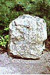
 Quartz monument marking spot where Stonewall Jackson was mistakenly shot by his own troops
There are few major monuments, making these battlefields more resemble Manassas than Gettysburg. There are two at Chancellorsville marking the spot where Jackson was mistakenly shot by his own men; an early, simple one consisting of a block of local quartz, and another, more traditional tombstone-like one. Similarly, a monument to John Sedgwick stands at Spotsylvania, where he was struck down by a Confederate sharpshooter. Human intervention takes a very unusual form on all the battlefields. In the Wilderness, one sees the narrow, shallow beds of tiny streams. Closer examination shows that many have raised banks, like miniature flood levees.
These are really the remains of trenches dug by the combatants. Many, especially on the Wilderness battlefield, are not readily obvious. Others on clearer terrain dominate it. This is the case with Spotsylvania, especially at the Bloody Angle. There, and extending to the East Angle, one can see an extremely extensive network of entrenchments. On all four battlefields, but especially Spotsylvania and the non-urban extension of Fredericksburg, the trenches are among the most important manmade additions to the battlefield.
The eroded trenches are not the only ruins in the parks. One of the most historically critical is the site of Chancellorsville. Not a town in spite of its name, it was a crossroads tavern, already past its best days, when Joseph Hooker used it as his headquarters following his drive across the Rappahannock. Later it burned to the ground, and today all that remains are a few courses of foundation stones.
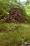
 Catherine Furnace
The Catherine Furnace stands about a mile to the south, in some of the thickest woods on the Chancellorsville battlefield. An important iron works prior to the war, today all that remains is the stump of the smelting furnace.
About a mile to the east on the Furnace Road is the site of the last meeting between Lee and Jackson. But midway between the furnace and the "Lee-Jackson Bivouac" is a place of definite interest to the nautically-minded. It is the birthplace of Matthew F. Maury, the naval officer who founded the science of oceanography, then served as an officer in the Confederate navy. Again showing the tendency of nature to reclaim her own, there is no sign of the Maury house.
Going south from the Catherine Furnace, one can follow what is today dubbed the Jackson Trail. Following the route of the Furnace and Brock Roads in 1862, it marks the path taken by Jackson's corps to the west, and its devastating flank attack on the Union XI Corps.
The National Park Service has made a sustained effort to making the Jackson Trail conform as much as possible to the standards of roads in the 1860's, compromising mainly to make it wide enough to accommodate automobiles. Thus the Jackson Trail is a rather rough, dirt track, darkened by the thick woods and shadows typical of the Wilderness area. In one place, the trail goes from dark and forbidding to a little disturbing. In keeping with the desire to make it as authentic as possible, the National Park Service has declined to bridge a small stream that crosses the road. Instead, it has left the ford in place, paving its bed, and building a small dam on the upstream side to control flooding.
For late twentieth century sensibilities, it is not a comfortable feeling to drive a new car through a stream, with water pouring over a barrier on one side, and a flood gauge on the other showing just high it could get on the other.
There is another, more melancholy route associated with Jackson. Following modern roads with such amenities as asphalt and bridges, one can drive to Guinea Station, about fifteen miles to the southeast of the Chancellorsville battlefield.
This is the Stonewall Jackson shrine. There, the wounded general was driven by ambulance from Chancellorsville to recover in a plantation outbuilding. But after some promising signs of recovery, he went into decline and died.
Today the building is preserved as the Stonewall Jackson Shrine, the loneliest part of the greater park complex. It stands in some of the clearest, flattest terrain within the park's boundaries, alone but for the railroad tracks nearby, and the occasional speeding passenger train.
For transportation among the battlefields and associated sites, such as Chatham and the Stonewall Jackson Shrine, a car is mandatory. The park has some of the longest distances between points of interest of any Civil War site. For example, it is approximately ten miles between Prospect Hill at Fredericksburg and the next recommended stop, the Chancellorsville tavern site. On the other hand, a complete circuit of Antietam is just eight miles.
At the same time, each battlefield demands exploration on foot. All have extensive hiking trails, with freely available maps. Even though the infamous undergrowth of the Wilderness is now appreciably more civilized, much of all the battlefields, even much of Fredericksburg, is too rough to be accessible by any means other than by foot. Traveling between and among the battlefields is a unique experience. Despite the growth of Fredericksburg over the past century or so, urbanization is not really a problem.
Once beyond the borders of the town, the atmosphere is largely rural, with far less traffic than Manassas or Gettysburg. Likewise, there are fewer casual people; similar to Antietam, these battlefields seem to attract more true Civil War enthusiasts, and fewer of the casual tourists more interested in finding a cool T-shirt than learning history..
Once on the battlefields, Fredericksburg and Spotsylvania National Military Park offers that most precious and rare experience for the Civil War traveler; the solitary visit. There is something almost indescribably emotionally evocative to stand among the trenches in the Wilderness, or at the Bloody Angle, alone and in the lengthening shadows of an uncharacteristically cool spring evening. It is at such times that one arrives at a conclusion that is startling, but nonetheless obvious. Among the entrenchments, one realizes that more than formal works of stone, these, the work of the soldiers themselves, are the more worthy monuments to the men who fought these battles.
Getting There
Fredericksburg and Spotsylvania National Military Park is located about halfway between Washington DC and Richmond VA. There is easy access to it via Interstate 95, and the traveler driving from the former can count on his trip taking about an hour. However, congestion around Washington can increase both drive time and frustration. The exits for the park are clearly marked and are at Virginia Route 3. The visitor has a choice of starting his visit at Fredericksburg or Chancellorsville; for the first, he heads east, and for the latter west. Both have visitor centers, though Fredericksburg's is larger and more elaborate. By contrast, the Wilderness and Spotsylvania battlefields have only unstaffed, glorified picnic shelters.
Back to Cry Havoc #22 Table of Contents
Back to Cry Havoc List of Issues
Back to MagWeb Master Magazine List
© Copyright 1997 by David W. Tschanz.
This article appears in MagWeb (Magazine Web) on the Internet World Wide Web. Other military history articles and gaming articles are available at http://www.magweb.com