John Walsh's 1995 articles in FE 23-26 on Napoleon's 1796 battles in Italy made me wish to visit these battlefields. If I can I do that at that time of the year when the historical battle was actually fought. This gives you the right feeling because the mood a landscape conveys in spring is quite different from that of winter when all the trees are stripped of their leaves and the sun is standing low.
As it was already the turn of the year I chose to visit the Rivoli battlefield which was fought 14 January 1797. With January 1st to 6th at my disposal I would have 4 days for the battlefield. As car fan and mindful of Mr. Walsh's warnings not to depend on public transport I would go there by car.
In Austria the high days passed very cold but with sunshine. On Tuesday December 31 I called the weather service to ask about next week's weather forecast for the region of Lake Garda. The answer was "I'm sad to tell you but there will be fog, snow and/or rain". The next setback were the traffic news: the shortest way to Italy via the motorway heading South from Vienna through Carinthia and the Venetian plains was covered with ice what had already caused several nice mass carambolations.
Nevertheless I decided to go there gambling on that even the weatherfrogs are wrong sometimes. To avoid the troubles in the South I took the western motorway and by the Tyrol and the Brenner pass would approach Rivoli from the north which would take me 10 hours. As celebrating new year was exhaustive and wavering to go or not was timeconsuming it was 4 p.m. before I left. So Wednesday January 1, 1997 I only reached Viturbo (Sterzing).
Getting up early (5.30) next day's morning not to loose this day. My Italian motorway colleagues must have cursed that Austrian driver steering several times to the breakdown lane jumping out of his car just to take a photograph.
About 10 a.m. I reached Rivoli: everything was covered with snow. Last winter being one of the coldest winters in Europe for long it was the first time since 1985 that they had snow there. Then I drove to the village's sole hotel the "Napoleone" to get a room for the 5 nights. "Mi dispiace Signore" (I regrett Sir) but we have a burst of the water main". Then it started gently raining. That's what you get when you do not believe the weather forecast.
I went to Caprino (brigade Ocskay's night encampment on 13 January 1797) to look for a hotel. In the mean time it was raining harder starting to wash away all the beautiful snow.
Home
So I decided to return home. Anyway I wanted to make a short tour just to get myself acquainted with the scene to know where to go at a future visit. I drove to the higher ground in the north to Lubiara to get the sight as the Austrians would have seen it. I took a sideway and ran my car into three feet of snow. It took me two hours to get my car out of that. For the first time in my life I was forced to use my no skid-chains.
Then I decided to have a look at Forte San Marco on the Monte Magnone. I worked through snow piled up by the wind to three feet and now heavy from the rain. When I emerged out of the woods it was pouring rain and a strong wind made me feel the cold even more. But there in the dawn it was: the semi-cirle of hills I knew so well from the maps. That must have been the view of the Austrian Grenzers which are said to have captured Chapel San Marco in the evening of 13 January 1797.
At it was already late now I stumbled down to my car soaking wet to skin. It was too late now and I was too tired to do a 10 hour night drive back to Austria. So I checked into a hotel in Caprino determined to go back to Vienna next day. When I awoke January 2nd and opened the hotel window the sky was blue and the sun shone brightly. Seldom had I been in my clothes so fast.
I skipped breakfast, got my things together, drove to the foot of Monte Magnone. This time I ran up to Forte San Marco and further to the South where Monte Magnone starts headlong to scale down. Now there was clear sight of the Adige, Rivoli with the Castello, the Trombalore heights , Caprino. And even the Monte Baldo (the courageous mountain) would show me his head bare of clouds.
The next four days I would spend from dusk till dawn exploring the site. I would return to Austria 2 a.m. Monday January 7 glad to have gone to Rivoli. Even encountering a ghost driver twenty minutes before reaching home could not distract from that.
John Walsh in FE 25 had described Rivoli as a "big place". Living in an Alpine country I had thought Rivoli could not impress me. I was wrong. Seldom had I seen such natural beauty which I hope is conveyed by the photographs. It is a great place, no it is fantastic: In contrast to France, Germany and Austria there in Italy there is no "Alpine foreland".
In the surroundings of Brescia and Verona the large plaine of the Po ends and the Alps suddenly rise to 500 sometimes even 1,000 metres. And that is also true of the last part of the Adige valley before that river leaves the Alpine region and enters the Po plaines: the Adige valley runs at some 100 m above sea level, the accompaning mountains reach 600 and more metres and Monte Baldo at some 5 kilometers distance more than 2.000 metres. Down from Trient the valley is very narrow. Often the Adige leaves only a narrow strip of land between its waters and the rocks. You can imagine how easily a small force could block an enemy advance.
That what gives the battle of Rivoli its specific touch is the semi-arc of the Trombalore hills. Looking like a vulcan or meteoric crater they have a diameter of almost 5 kilometres. They are the morains of an ice-age glacier arm having come down the Adige valley. Lake Garda is the remnant of the main branch of that glacier. Rising some 100m above the level of the land in their inner they are covered with brush. A path allows you to walk their whole stretch.
On their northern part was the first position of the French from which they were forced by the Austrians and which they retook in the course of the battle. On the plaine inside the arc Napoleon stayed during the battle and there he had positioned his reserves. To the South there are some trenches the Austrians are said to have built during 1798 and 1799.
The first thing that catches your eye are the many good visible fortifications of the region. I took the following from an Italian/German guide to the forts of the region, I bought in the Museo Napoleonico of Rivoli: None of these fortifications was there when that battle of Rivoli was fought we are interested in. The most were built after the First War for Italian Independence 1848-49 by the Austrians to saveguard their debouch out of the Adige valley. They were all named after Austrian officers which had distinguished themselves during that war. Forts della Chiusa, Mollinary and Hlavaty are situated on the left or eastern bank of the Adige. Fort Wohlgemuth is the one on the western: it is the cylindrical one in the vicinity of Rivoli which inevitably is depicted by every shot you take of the village.
It was built on the site of an old Venetian castle. (I do not like to point out others' errors but the text under the upper photograph p.6, FE 26 is not correct: it runs "View of Castello Rivoli on top of Monte Pipalo, the hill of which the Austrian General Lusignan was captured during the battle". True is Fort (not Castello) Rivoli is on top of the Monte Castello deriving its name from the old Venetian castello (castle). Monte Pipallo as correctly shown on the maps FE 25, p.23 and 24 is to the South. There is no fortification there and it is there where Lusignan's column had to surrender to the French.)
One cannot visit any Chapel of San Marco no more. Any post 1890 picture alleging to show the chapel cannot be correct (like Photo 2, FE 22). It was razed when between 1888 and 1913 the Italians built a (beautiful) fort facing north on the very ground. During WW I none of the forts saw action. The front was more to the north. Outdated they were not regarded as serviceable. Forte San Marco offers an impressive pre WW I-fortification but from there you also have the best close view over the battlefield from the north.
And it is dramatically built on the Monte Magnone. While one slope moves down more or less gently to the Tasso valley at the other you look down a headlong rocky precipice to the Adige valley.
This was the scene of the decisive event of the battle: Quosdanovich's Austrian column on the right bank of the Adige tried to join their commrades on the Trombalore heights. A charge of the 1er regiment de cavalerie under Leclerc threw them back and prevented that. At the feet of the gorge is the Italian Fort Incanale whose middle part has been razed to allow the modern road on the western bank of the Adige to pass. Even today the road is step and has several bends. To your right the rocks of Monte Magnone are towering above you. In the vicinity you'll find the monument commemorating the battle.
The first monument was erected in 1806 and was destroyed in 1814 when the Austrians returned. When the modern monument was built I don't know. Although it is quite big it is hard to find it: leave the road to Incanale at the second bend where the yellow sign "monumento Napoleonico" tells you to go; follow the field path through the tunnel through the dam of the modern channel. Immediatley afterwards turn left then follow the field path making a wide turn to the right leading you dircetly to the monument encircled by an arc of cypresses.
There is not to much to be seen in Rivoli itself - there was no fighting there. It has the typical Italian church from whose place in front you have a fine view of the Adige 100 m below. There will be two museums related to the battle. The older one is the Museo Napoleonico situated in a brown building 14, piazza Napoleone I. That is in the center in the very neighborhood of the church. It contains many items like pictures, uniforms and weapons dedicated to the battle and two dioramas. The custodian is Signora Vaona Jole. If she is not there call her under 045 - 728 13 09. Opening times are 9-12 and 15-18 (winter 17). Groups should give notice of their arrival.
The second museo will be situated in Fort Rivoli (Wohlgemuth). Its exhibitions' theme: "Rivoli 1797: people and territory in the scenes of the battle". I say "will" because when I had been in Rivoli it hadn't yet opened so I can't say anything about it. I chanced to meet Mrs. Virginia Cristini secretary of the exhibition comitee at my second visit of the Museo Napoleonico. As she was burried in large amounts of paper the effort seems to be great and it might be justified to expect a fine thing. (If I have understood Mrs. Cristini correctly I fear that this exhibition is to last only until October 1997. Afterwards the commune will use the renovated fort for other purposes?)
The Monte Pipalo is there where Lusignan's column had to surrender to the French. It is no good to go there to get a view of the battlefield from the South because the trees are so high there that you can't see anything. Instead go East to La Rocca (the rock) a sugar-loaf like mountain to the Southeast of the battlefield. There was no fighting there but La Rocca gives you the said outlook and a dramatic view over the Chiusa Veneta and up the Adige valley. Headlong below you flows the Adige. And there are some remnants of medieval fortifications. Take the road to Pontone cross the Adige there and move up the Adige valley. Thus you'll come to the Chiusa Veneta.
A little bit to the North is Ceraino. In the Adige bend nearby Vukassovich had placed his guns. You can strole along the river and have a look at the rock (Monte Castello) on which Fort Rivoli is built. If you continue to the North to Peri to recross to the western bank of the Adige do not look for the opera Napoleonico, a rampart Napoleon had built to block the Adige valley.
Although it is still shown on the Italian maps it obviously has fallen victim to the extension of the vineyards. Now back to the western side of the Adige again heading south you reach Brentino (at left) - scene of a bloody combat on 29 July 1796.
Its church illuminated during the night is a fine view and high above you can see Madonna della Corona (see below). Advancing further South you reach Incanale and by the "Osteria gorge" the Rivoli plateau.
Of interest is Madonna della Corona (at right) a little pilgrimage church built into a step rocky precipice. Because it can be seen from the Adige valley it is often mistaken for the San Marco Chapel which as already mentioned doesn't exist any more.Further to the North is the small village of Ferrara around which is the wellknown "position de Ferrara" Joubert was forced to leave during the Castiglione campaign and again during the night of 12 and 13 January 1797. 11 and 12 January the Austrians had tried several times to force the bridge but had always been repulsed by the French.
Still further to the north the Italians have built several other forts close to the pre-1918 frontier: Forte Cimo Grande, Forte di Naole and Forte Masua. And anyone interested in that can visit endless trenchsystems of WW I. The skill of the Italian engineers can be studied by the many roads winding up bend upon bend throughout the whole region.
Rivoli was and is a small village. Anyway the commune is making every effort to put the historical event to its due place: 17 - 19 January 1997 there were an International Historians' Convention and an official ceremony with laying of wreaths, blessing and French, Austrian and Italian anthems. During March the said exhibition in the Fort Rivoli must have been inaugurated. Saturday 12 and Sunday 13 there will be the reenactment with reenactors from all over Europe. Saturday 16 August there will be a walk over the battlefield.
If you travel by air you can touch down at Milan or Lake Garda's summer airport Villafranca. When going there by bus and coming in from the west (Milan) you will have to use motorway A(utostrada) 4. Although it is the longer way head for the A22 and avoid Peschiera which will be crammed with tourist cars during summer.
If you can, go there from the north - say from Munich or Innsbruck - and follow the motorway up the Inn valley taking you through the scene of the Tyrolean sideshows of the 1805 and 1809 campaigns to the Brenner Pass. Then follow the Italian motorway A22 from the Brenner Pass to Lake Garda. It is one of the lovliest motorways I ever went: high mountains scaling up to your very right and left, a medieval castle on every second summit. That is the route Austrian armies have taken so often in their many campaigns on Italian soil from 1693 to 1866/1918.
You can leave the motorway in the Adige valley still to the north of Rivoli at Ala/Avio and continue South on either side of the Adige river. I recommend to stay on the western bank as this would directly lead you to Rivoli. Otherwise you can leave the motorway to the South at Affi then go back to Rivoli giving you the scene as seen by the French reinforcing Joubert. Don't forget that you have to pay on Italian motorways. Make sure that you have got enough Liras in cash ready.
For those who do not camp or want to bring families with them the best thing is to go to Caprino, twice night's lodging of Ocskay's column, today capital of the district, where are several hotels. Lake Garda is a touristic zone so take care: I would not recommend to go there on short notice. - And take good (heavy) shoes with you, this is the Alps! The same pertains for warm and rain-proof clothing: Lake Garda is famous to wind surfers for his "good" wind but also for sudden thunderstorms and torrential rain!
Conclusion: I strongly recommend to come to the reenactment 12 July 1997 even if like me not an reenactor. It is the only big truly Napoleonic bicentennary of the year. What about defending or attacking something akin to a vulcanic crater? The inhabitants of Rivoli seem to do their utmost to honour the historical event. And for flatland indians who have never seen mountains higher than 20 metres the reenactment might turn out to be an adventure as it will take place in a scene that nature has shaped to wild and bizarre forms. It is a great place! So to Rivoli - march!
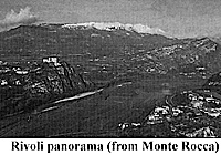 I presume that the most readers are well acquainted with the historical background, place and run of events of the battle of Rivoli. For those who are not I recommend to turn to John Walsh's article on the battle of Rivoli in FE 25 and 26, the Esposito & Elting Atlas or David Chandler's Campaigns of Napoleon. Note that Rivoli actually has seen 3 combats: that of 17 November 1796 during the Arcole campaign - an Austrian victory, the famous battle of 14 January 1797 and the combat of 22 July 1848 between Austrian and Italians (and perhaps many more small encounters between 1701 and 1945).
What to Visit
Nature
The Trombalore Heights
The Austrian Forts
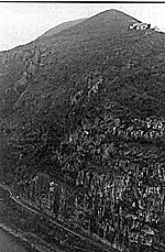 All these forts were facing south against a possible (Italian) threat. When then unified Italy conquered that region after the War of 1866 the Italians modified the forts so that they could fire north (and of course renamed them: Forte della Chiusa, di Monte (Mollinary--as seen at right photo, perched near thetop of the hill), di Ceraino (Hlavaty) and di Rivoli (Wohlgemuth). Forte di Monte the one on the eastern side was severly damaged during WW II. Forte della Chiusa was blown up when the modern road on the eastern bank of the Adige was built.
Forte San Marco but no Chapel San Marco
The Osteria Gorge
The Monument
Rivoli the village - The museums
Monte Pipalo - La Rocca
The Chiusa Veneta
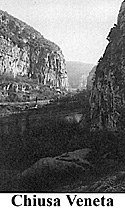 Since the middle ages any voyager going to Italy and crossing the Alpine main crest at the Brenner pass had to go through the Chiusa Veneta (Venitian defile--at right). And since the middle ages the latter has been praised for its beauty. There the rocks on both sides of the Adige come so close that they leave only the space for the river on the one side and for the road on the other.
 In the middle ages the Venetians had built a small castle there which existed in 1797. In 1848 the Austrians replaced it by Fort Chiusa Veneta the remnants of which can be visited still today. It is a strange feeling when you stand there - the rocks rising sky scraper like above your head and to your feet the Adige flows silently and emerald green.
Pazzone - Madonna della Corona- Ferrara - I forti nuovi (the new forts)
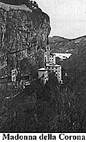 Although not actually battlefield the territory further to the North of Caprino is interesting as well. That's the way the Austrians had come several times during the 1796 campaign to attack the French. In January 1797 it was covered with 1-2 feet of snow. Stop at Pazzone Alvinzy's headquarters and look back: that's the view of the advancing Austrians.
The bicentennary: reenactment 12 and 13 July 1997
2 How to get there
3 Where to find shelter
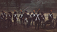 The 4eme Battery deploys for "revolutionary" action in Italy. This will be in the field again at Rivoli 1997.
Back to Table of Contents -- First Empire #35
Back to First Empire List of Issues
Back to MagWeb Master Magazine List
© Copyright 1997 by First Empire.
This article appears in MagWeb (Magazine Web) on the Internet World Wide Web.
Other military history articles and gaming articles are available at http://www.magweb.com